Drone Data And Analytics Will Accelerate Adoption Of Digital Technologies In Infrastructure Domain
An Authored Column by Rahul Sankhe, President & Co-founder, SenseHawk analyzing the recently published Drone Rules, 2021 and sharing an insight into India’s potential to become the global drone hub by 2030 as envisioned by the Government…
The recently published key features of Drone Rules, 2021 are a welcome departure from the earlier framework set forth in March this year. It now incorporates industry, scientific, and academic feedback, and is based on mutual trust and self-certification. This will encourage the drone industry to innovate while reducing the fear of intrusive regulation.
How A Simpler Regulatory Framework Will Encourage Use of Drones
The latest framework eliminates heavy paperwork, drastically reduces fees and waives permissions while offering a single window for all clearances through the Directorate General of Civil Aviation’s (DGCA’s) Digital Sky platform. The change acknowledges the tremendous benefits of drone data and encourages its uptake for business and innovation.
Drone Rules, 2021, reduces the number of user forms from 25 to just 5, and operating fee categories from 72 to 4. The framework cuts down the overall quantum of fees and required approvals while extending pilot-license validity to 10 years. Further, it does away with the need for a security clearance prior to the registration or issuance of a license. The Digital Sky platform will also have an interactive airspace map detailing the green “fly” zones, where drones can be operated freely up to a vertical distance of 120 meters.
While the import of drones will still be regulated, no permission will be required for the import of components. The new rules allow foreign ownership for companies operating drones in India. Significantly, the remote pilot license will not be required for non-commercial micro drones and nano drones that weigh less than 2 kg. This covers most industrial drones with thermal and visual sensors.
What Drone Tech Can Offer Power and Other Infrastructure Projects
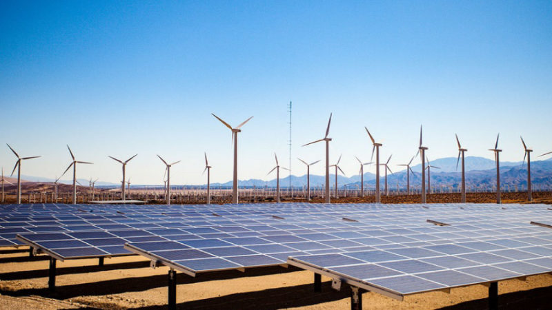
The Indian infrastructure sector stayed resilient through the COVID-19 pandemic. The Economic Survey of India estimates a government infrastructure spend of more than 100-lakh crore (100 trillion) rupees during the 2020-2025 period. New power distribution schemes in the country alone will receive INR 305,984 crores over the next 5 years (Union Budget, 2021). The use cases for drones span the power, road, railways, urban development sectors, and many more.
As Government support for clean energy, sustainable initiatives, and smart cities grows, the integration of advanced technologies to speed-track development is inevitable. Man-power safety delayed deadlines, and efficiency considerations during pandemic recovery have put a spotlight on the advantages of using drones in the construction, operation, and maintenance (O&M) of such projects. Drones and drone-data analytics-based workflows can help all stakeholders with granular data at each stage, i.e. development, construction and operations.
High-resolution drone imagery will help generate geographic information system (GIS) maps and terrain profiles to enable better decisions around site selection, construction challenges, and project planning. Additional benefits of drone-based GIS data include estimation of site grading requirements, hydrology assessment of the site, and the planning of drainage systems and stormwater pollution prevention plans (SWPPP). Since climate change impact is now well-understood, mitigation measures need to be undertaken while designing and constructing new infrastructure projects. Drone-based data will help in diminishing hydrology-related risks through the design of optimal drain networks as per the topography of the site.
During construction, regular drone surveys can facilitate easy onsite and remote monitoring. Integration of mobile apps and web-based applications with drone scans enable the managing of actual site work through the creation of geo-located tasks and punch lists that can be used to assign work efficiently to field teams and also monitor completion. These digital tools enable collaboration across various internal and external stakeholders, ensure on-time completion, and reduce the risk of budget overruns.
While sites vary in size, complexity, and location, a robust construction monitoring and performance management solution will allow project managers to visualize and create workflows for routine and one-off tasks for groups and individual team members, and to accurately know the on-ground reality at any time.
Why Drone Data Harnessing Will Speed Up Decision-Making and Optimise Outputs
Every infrastructure project is a one-time process of development and construction followed by periodic schedules of maintenance and productivity optimization measures. Data collected using drones can play a critical role in enabling decisions that improve on-time execution at the desired level of quality.
Indian conglomerates and investment trusts as well as engineering, procurement and construction (EPC), project management, and independent engineering companies can all have an in-house-drones-coupled-with-a-platform approach to manage drone data. Innovative start-ups are offering cloud-based software and analytics tools that will probably become an integral part of infrastructure construction and O&M toolkits within the decade.
For instance, while designing and building a solar project, drone data with cloud-based software and analytics can help analyze, organize and manage terrain data to support design and construction processes. This simplifies site data management. For example, terrain scans using drones can help clearly identify Right of Way (ROW) issues for roads and transmission lines. This enables planners to take appropriate decisions with regard to the final routing.
Drones can be used to track construction giving accurate visibility into progress and quality of construction from any remote location. Color-coded sitemaps linked to completion status can be accessed for civil, structural, or electrical activities. Field engineers can use these sitemaps with map-based applications to drive decisions and activities on the ground. Subject matter experts in the head office can provide guidelines to rectify and close all identified issues. Work management becomes seamless as tickets, checklists, and punch-lists are correlated to features identified during drone scans to streamline on-field work execution.
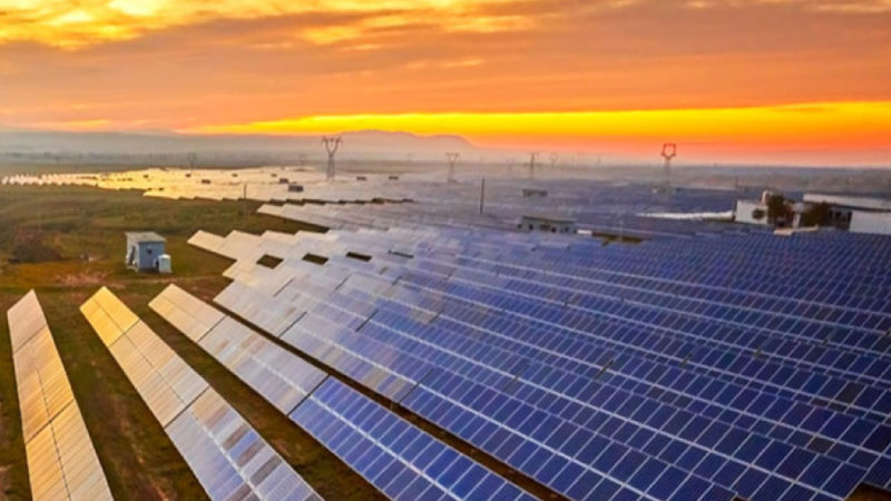
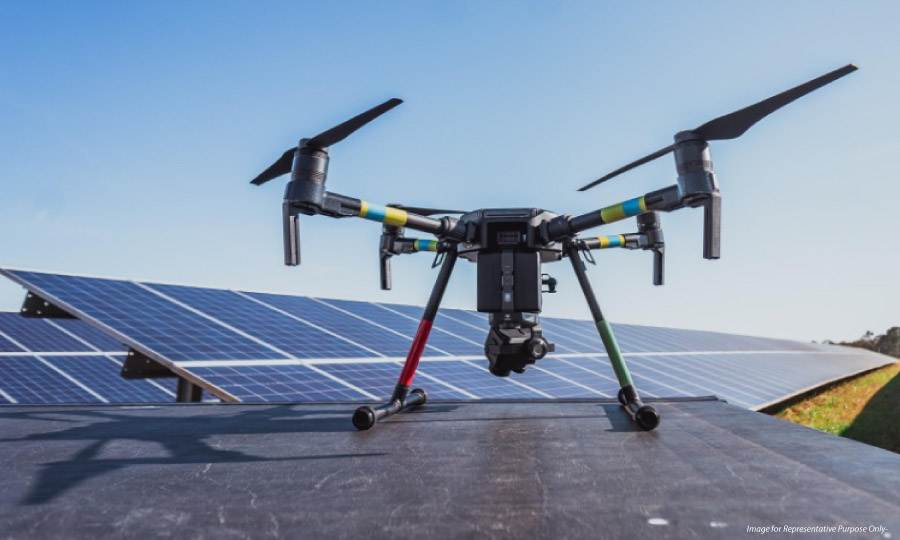
Drone surveys also have exceptional usefulness during operations. Visual and thermal scans using drones can detect anomalies and generate early warnings of potential performance degradation or failures. For instance, in solar, thermal drone scans can detect hotspots early, evaluate the energy loss, schedule any maintenance, track defects over time, and enable timely remediation. In transmission, thermal scans can help track damaged insulators and highlight potential risks of arcing, and visual scans can detect risk vegetation growth and also identify tower structural issues. In coal power plants, drone scans can quickly measure coal stockpile volumes with >99% accuracy and help detect coal smouldering early to avert potential fires.
Recently, a solar developer in India used drone thermography and analytics to assess the health of 2.5 million photovoltaic (PV) modules, spread over 1,000 hectares in 10 days using drones. Without drones, the developer would not have undertaken this exercise as a manual scan would require many months and unavailable trained resources that must manually collect data from such a large site.
Similarly, a road construction company recently used drones to monitor the status of road construction. Drone scans, combined with appropriate software, were used to track construction progress versus design layout. A single drone was able to scan up to 50kms of road stretch per day.
Where the Drone Rules Could Be Strengthened to Support Drone Start-ups
Drone Rules, 2021 has reduced the compliance burden for drone start-ups significantly, and the country may potentially be on its way to becoming the global drone hub by 2030 as envisioned by the Government, but many essential reforms and clarifications are yet to be notified to support this possibility.
Drone industry participants are looking forward to the strengthening of policies regarding safety and security features like ‘no permission, no take-off’ (NPNT), real-time tracking beacon, and geo-fencing that may be notified within the coming 6 months.
The Digital Sky platform too is yet to be fully ready in terms of airspace mapping and air traffic control management systems. Substantial work remains to be done on policies to enable applications such as beyond visual line of sight (BVLOS). BVLOS drones can have a meaningful productivity impact for ‘corridor’ applications such as roads, railway tracks, pipelines and power lines that stretch linearly across thousands of kilometers.
Overall, Drone Rules, 2021 is a heartening development for unleashing the reach and versatility of drone tech across sectors. In addition to energy and infrastructure, drones can find robust use in surveillance, agriculture, mining, emergency response, and transportation, among other uses.

President and Co-founder SenseHawk
About Author
Rahul is the President and Co-founder of SenseHawk, a leading provider of AI-powered software for solar lifecycle. An alumnus of IIT, the University of Texas, and ISB, Rahul has a background in cleantech, climate change, and national solar policy. SenseHawk was envisioned to further his goal of helping solar companies streamline processes and using automation to enhance productivity.
Follow Author: LinkedIn | Twitter
Connect with Power Insight: Facebook | LinkedIn | Twitter